

London, December 06, 2025
Experts employing ultrahigh-frequency seismic waves have developed a rapid, non-invasive method to assess soil health globally. The Earth Rover Program, rigorously tested across multiple continents, provides detailed 3D imaging of soil properties that can help farmers and policymakers enhance agriculture sustainability and crop yields.
Seismic Imaging Technology
Ultrahigh-frequency seismic waves are now used to generate detailed three-dimensional images of soil structure and condition beneath the surface. These waves respond to soil characteristics such as density, moisture content, porosity, texture, and organic carbon levels, enabling comprehensive soil health assessments without physical disturbance.
The Earth Rover Program leads this innovation with a system that can resolve soil features at a 10-centimeter resolution. This precision captures intricate details in both topsoil and subsoil layers, providing valuable insights for agricultural management.
Global Validation and Practical Uses
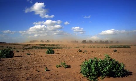
The technology has undergone extensive field tests with identical sensor setups in Europe, Africa, and South America. These trials confirm consistent, high-quality data output across diverse ecosystems and farming systems. Moreover, the system has demonstrated capacity to discern impacts of various agricultural practices such as tillage, cover cropping, and grazing on soil condition.
For farmers, this capability addresses the traditional challenges of costly, slow, and invasive soil testing methods. It offers fast, affordable, repeatable assessments for detecting compaction, drainage issues, or carbon deficiencies before these affect crop yields.
Operational Mechanism
The process begins with sending seismic waves into the ground using small-scale equipment like hammer plates or lightweight vibrators. Sensitive surface sensors record the resulting vibrations, which are then analyzed by artificial intelligence to produce precise 3D maps of soil bulk density, moisture levels, and porosity.
The resulting data is delivered through digital platforms, enabling farmers to receive actionable insights within hours. The system is designed to be low-cost and easy to deploy, making it suitable for smallholder farmers as well as large-scale operations.
Advancements Over Traditional Methods
Historically, soil health measurement has faced limitations due to the destructive nature of physical sampling, the superficial reach of satellite remote sensing, and the slow turnaround of laboratory analyses. Seismic imaging offers a crucial intermediate solution by penetrating to root zones and capturing water movement dynamics swiftly and at scale.
This advances early detection of soil degradation—such as compaction, erosion, or drying—which can inform precision application of water, fertilizers, or conservation measures. Additionally, it enables monitoring soil carbon changes, underpinning climate-smart agricultural strategies.
Background and Future Outlook
Soil is a complex and critical component of agricultural ecosystems, yet remains under-measured worldwide. The Earth Rover Program’s integration with AI and local expertise aims to evolve into global soil data networks that support sustainable land management and food security goals.
Ongoing research, including work from Purdue University on optimized seismic sensor arrays, continues to improve cost-efficiency and data accuracy. As the technology matures, seismic soil imaging could become as indispensable to agriculture as GPS and drones have become in recent years.
This emerging approach offers a transformative pathway toward better soil health monitoring, allowing early interventions and tailored farming practices that enhance productivity while preserving environmental resources.